Our programmes

Four programmes, one mission

Each programme is designed to work independently in any Ghanaian community, and together as a complete environmental restoration system.

Programme 1 · Phase 1

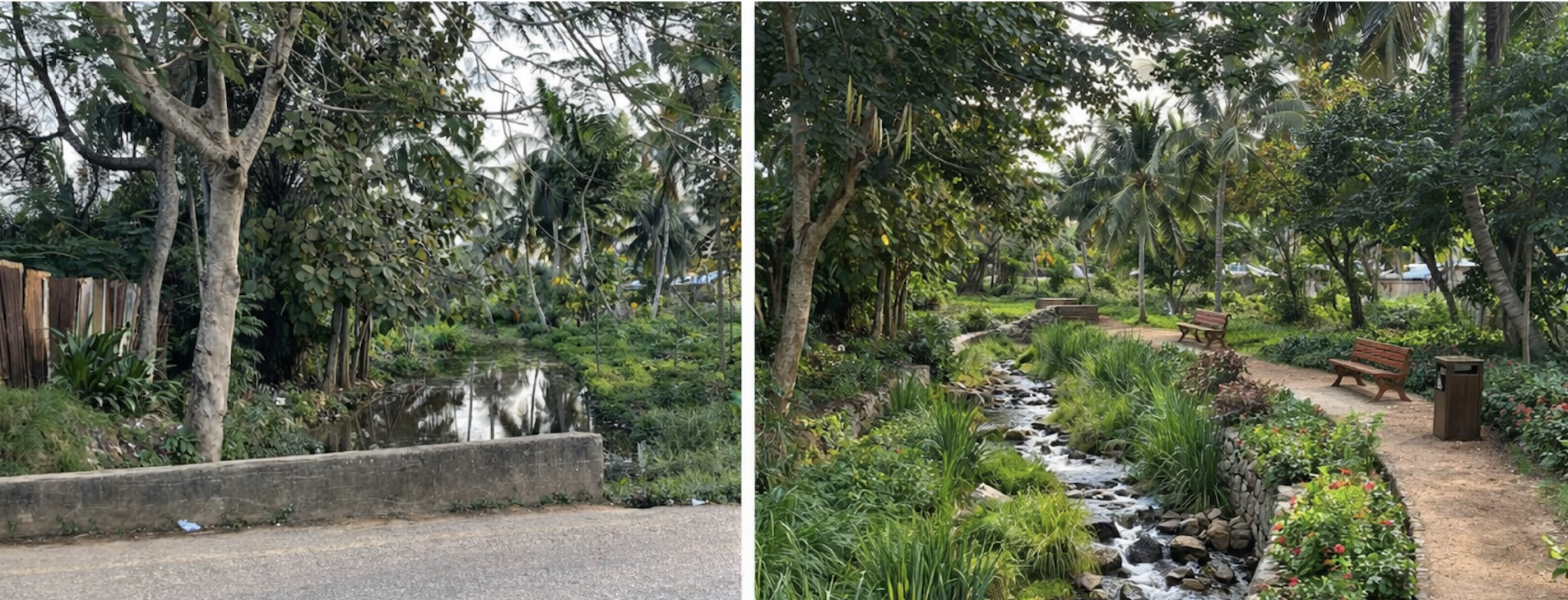
Blue Corridor: waterway and drainage restoration

Stagnant, polluted waterways and blocked drains are documented, rehabilitated and transformed into flowing community streams with landscaped banks, seating and flood-control engineering. Each restored waterway is handed back to the community and permanently recorded in the Ghana Data Commons. Starting in Akyem Tafo, scaling nationally.

Before and after, a restored waterway in Ghana
Phase 1 Public health Flood control Handback model Data Commons
Programme 2 · Phase 1

Green Canopy: geocoded town tree planting

Every tree planted by GreenPulse Ghana receives a unique ID, GPS coordinates, species record, planter name and a lifetime growth tracking log. Fruit trees, shade trees and native forest species are planted in a deliberate mix chosen to feed the community, cool streets and restore local ecology. Ghana's first community-managed urban tree database, publicly accessible and open to all. Trees planted on remediated land are fed by compost produced during site treatment.

A tree-lined path in Ghana representing the Green Canopy programme
Phase 1 Fruit + shade + native mix Carbon tracking Open database
Programme 3 · Phase 2

Land Remediation: dump site treatment and handback

Irregular dump sites across Ghana are documented, physically treated and the land restored. The harmful dump is replaced with a properly managed community waste collection system. Every site follows our six-step lifecycle and is handed back with a Site Restoration Record published to the Ghana Data Commons.

Restored land with green crops growing where a dump site once was
Phase 2 No burning Land restored Handback model
See the full six-step process →
Programme 4 · Phase 2

Ghana Data Commons: community environmental mapping

University student interns from KNUST, University of Ghana, UENR and other institutions collect and map 13+ layers of community data using free open-source tools, KoboToolbox, ODK Collect and OpenStreetMap. All data is published openly for planners, researchers, donors and communities nationwide. Every restored site adds a permanent before/after record to this dataset.

GIS data map showing community environmental data layers
Phase 2 Open data University interns
See all 13 data layers →
Programme 5 · Academic Partnership

Field Learning: study abroad and internship programme

GreenPulse Ghana partners with universities in the United States and Ghana to bring students directly into active restoration sites. Study abroad participants and local interns work side by side as a single field team, contributing real data, real labour and real documentation to live projects. Student work is not simulated — it contributes directly to the Ghana Data Commons and the permanent site restoration record.

Students and community members working together on a field restoration site
Study abroad Local internships Academic credit Field research US + Ghana universities
See full programme details →

Support our programmes

Sponsor a tree, fund a site cleanup, or support our data collection work.

Support our work →